Brownfield Planning for Climate-Resilient Cities
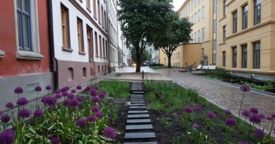
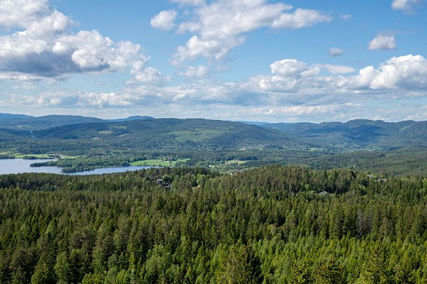
Photographer: Dan Aamlid, NIBIO
How can architects, planners and municipalities reduce biodiversity loss while lowering project risks? Norway’s NIBIO has developed open mapping tools that help identify previously developed land, assess environmental risks and support more sustainable spatial planning.
NIBIO (Norwegian Institute of Bioeconomy Research) is one of Norway’s leading research institutes in the fields of agriculture, forestry, climate, environment and sustainable resource management. NIBIO conducts research and develops knowledge-based tools to support sustainable land use, biodiversity protection and climate adaptation.
Smarter Land Use Is Key to Protecting Nature
Across Europe, biodiversity loss has become one of the defining challenges for spatial planning. Urban expansion, infrastructure and fragmented development continue to consume natural land, even as governments commit to protecting ecosystems under the EU Biodiversity Strategy 2030, the Nature Restoration Regulation and national climate adaptation policies.
For architects, developers and planning authorities, this creates a fundamental question:
Where should we build if we want to reduce environmental impact while maintaining economic feasibility?
Norway’s Norwegian Institute of Bioeconomy Research (NIBIO) has developed a series of open digital mapping tools that help answer this question by identifying previously developed land, mapping valuable ecosystems and supporting evidence-based planning decisions.
Nature Cannot Simply Be Replaced
For decades, development projects have often assumed that environmental impacts could be compensated through tree planting or ecological restoration elsewhere.
However, recent research published in Nature Reviews Biodiversity concludes that biodiversity cannot generally be restored simply by planting trees. While forest restoration can provide important environmental benefits, restoration programmes have frequently prioritised tree cover rather than recovering complex ecosystems and biodiversity.
The authors argue that biodiversity should become a primary objective of restoration rather than an afterthought.
For planners and architects, this reinforces a key principle:
Avoiding damage to high-value ecosystems is often more effective than attempting to restore them later.
Brownfield Development Reduces Nature Loss
One practical strategy is to prioritise brownfield and previously developed land before converting agricultural land, forests or wetlands.
These areas include:
- former industrial sites
- commercial districts
- parking areas
- transport infrastructure
- redevelopment zones
- underutilised urban land
Reusing existing developed land offers several advantages:
- reduced biodiversity loss
- lower pressure on agricultural land
- more efficient use of existing infrastructure
- lower uncertainty during planning
- opportunities for urban regeneration
In many projects, existing ground conditions represent one of the largest sources of financial risk. Selecting appropriate sites early in the planning process can therefore reduce both construction costs and project uncertainty.
Wetlands Provide Irreplaceable Ecosystem Services
Wetlands deserve particular attention.
They are not simply vacant land suitable for development but complex hydrological systems that regulate water, store carbon, reduce flood risk and support biodiversity.
Current scientific knowledge indicates that relocating peatlands or wetland ecosystems remains experimental, with limited evidence that ecological functions can be fully recreated over the long term.
Avoiding unnecessary impacts on wetlands therefore remains one of the most effective strategies for protecting ecosystem services.
Open Mapping Tools for Better Planning Decisions
To support evidence-based planning, NIBIO has developed several national geospatial datasets in collaboration with the Norwegian Mapping Authority, Statistics Norway and the Norwegian Environment Agency.
Although developed for Norway, these tools illustrate how integrated spatial data can support sustainable planning throughout Europe.
Mapping Previously Developed Land
NIBIO’s brownfield mapping identifies areas already affected by human activity, including information about buildings, sealed surfaces and vegetation.
This allows planners to identify locations where new development can take place with lower environmental impacts while reducing pressure on undeveloped land.
National Base Map for Spatial Analysis
The National Base Map combines multiple public datasets into a single platform covering land use, ecosystems and environmental conditions.
For municipalities and planning authorities, this provides a common evidence base for evaluating development alternatives and understanding cumulative environmental impacts.
Ground Conditions Matter
Previously developed land is not automatically suitable for construction.
Ground conditions remain one of the most important factors affecting both safety and project costs.
Planning authorities should therefore assess:
- geotechnical conditions
- landslide susceptibility
- flood hazards
- contaminated land
- groundwater conditions
- soil stability
In Scandinavia and Canada, areas with quick clay require particular attention because landslides can develop rapidly with severe consequences for buildings, infrastructure and evacuation routes.
Although quick clay is primarily a Scandinavian challenge, the broader principle applies across Europe:
Ground hazards should be identified during the earliest planning stages—not after development decisions have already been made.
Early risk assessments reduce uncertainty, improve public safety and avoid costly redesign later in the project.
Green Infrastructure Supports Climate Adaptation
NIBIO’s Green Structure dataset maps urban vegetation in much greater detail than conventional land-use maps.
Rather than identifying only whether vegetation exists, it distinguishes different vegetation layers and habitat structures.
This information supports:
- climate adaptation
- urban cooling
- biodiversity planning
- sustainable drainage systems (SuDS)
- stormwater management
- resilient public spaces
Mapping Greenhouse Gas Impacts
NIBIO has also developed a spatial greenhouse gas calculator that estimates emissions and carbon storage associated with land-use change.
The tool enables planners to compare alternative development scenarios and incorporate climate impacts into spatial planning from the earliest project stages.
Identifying Valuable Natural Forests
Another important dataset maps forests that have remained largely unmanaged since before 1940.
These forests often contain higher biodiversity values, more complex ecological structures and greater carbon storage than intensively managed forests.
Making these areas visible during planning reduces the risk of irreversible biodiversity loss.
Supporting Better Planning Decisions
Together, the mapping tools support a wide range of planning processes, including:
- municipal spatial planning
- local development plans
- environmental impact assessments (EIA)
- biodiversity assessments
- land-use accounting
- climate adaptation strategies
- urban regeneration
- nature restoration projects
Because all stakeholders work from the same data, planning decisions become more transparent, consistent and evidence-based.
A Shift Towards More Sustainable Development
For architects and developers, these tools encourage a shift from expanding into natural landscapes towards making better use of land that has already been transformed by human activity.
For municipalities, they provide a stronger basis for balancing housing, infrastructure, economic development and biodiversity conservation.
As Europe moves towards climate-neutral and nature-positive cities, integrating reliable spatial data into planning will become increasingly important.
Building on previously developed land is not only an environmental strategy—it is also a practical approach to reducing project risk, improving resource efficiency and creating more resilient communities.
References
Brancalion, P.H.S. et al. (2025). Moving biodiversity from an afterthought to a key outcome of forest restoration. Nature Reviews Biodiversity.
Butters, C. (2026). Ground Conditions: Risk and Responsibility for Building Owners and Consultants. Greenbuilt.
Butters, C. (2026). Early Design Decisions Determine Building Costs. Greenbuilt.
Norwegian Institute of Bioeconomy Research (NIBIO). (2026). Five Mapping Tools for Climate- and Nature-Friendly Spatial Planning.
NRK. (2025). New Brownfield Mapping Helps Municipalities Reduce Nature Loss.
Also read: Nature-Based Solutions for Stormwater Management and Climate Adaption